

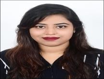
SMITANJALI PANDA
Bhubaneswar
Summary
Total 7 years of successful Production, Quality control,quality assurance & GIS Mapping Operation experience have proven my proactive leadership & creative work execution skills. Highly motivated, project-focused, with extensive experience in the field of map operations and client interactions. Well, exposed to various Mapping& Understanding of telecom regulations and industry standards, Utility Jurisdiction projects.
Overview
9
9
years of professional experience
Work History
Sr Fiber Design Engineer
Verveba Telecom
05.2025 - Current
- Based on ARAMIS drafting we identified fiber planning (fiber route, tower, small cell, cabinet, etc.).
- Identify required permits from local authorities for Jurisdiction (city, county, DOT, utility district).
- Common permits include right-of-way (ROW), excavation, building, electrical, traffic control, and environmental permits.
- DOT, CITY, COUNTY, RR(RAILROAD) & ACCESS., These are the type of permit we are working along with the TCP (Traffic Central Plan).
- By the help of Zw CAD we are doing this process.
- AT&T/contractor responds to comments and revises plans if needed.
- Once approved, permits are issued with conditions (work hours, restoration standards, inspections).
- Work is performed according to permit conditions.
- Inspections may be required during and after construction.
- ROW or site is restored to local standards.
- Final inspections and documentation close the permit.
Sr GIS Engineer
RamTECH Software Solutions
Bhubaneswar
12.2022 - 05.2024
- This is a Telecon Project. Main objective of the project is to design Fiber Distribution Hub (FDH) to the terminal Network access point (NAP) by deploying Fiber-to-the- Home (FTTH) using Gigabit Passive Optical Network (GPON) technology.
- FDH is telecom. This project is involved capturing of update the Telecom assets in Client database using Small World.
- Quality check maintain high delivery standard.
- Update the Fresh works order as well as new update work order reported by client.
- Based on source we are processed permitting on those Area’s if required.
- In this project, we are taking permission from the specific authorities that we are going to digging in that street.
- So as per UNDC spec there are types of the permit like: DOT, CITY, COUNTY, RR(RAILROAD) & ACCESS., These are the type of permit we are working along with the TCP (Traffic Central Plan).
- By the help of AUTO- CAD we are doing this process.
- Spatial NET is worked for the planning, design, and maintenance of telecommunications networks, including fiber, coaxial, and copper architectures.
- Engineers can design network layouts, plan expansions, and simulate different scenarios to assess the impact on performance and capacity.
- It offers seamless integration between outside plant (OSP) and inside plant (ISP) components, providing a comprehensive model of the physical network infrastructure.
- Facilitates the modelling of Hybrid Fiber-Coaxial (HFC) networks and Radio Frequency (RF) signals, including automatic signal levelling and recalculations to ensure optimal performance.
- Enables detailed tracking and management of fiber wavelengths, including channel multiplexing for CWDM and DWDM systems, aiding in capacity planning and optimization.
Sr GIS Engineer
ABSYS IT
Bhubaneswar
09.2021 - 12.2022
- This project entails capturing and updating electrical assets in a client database using Small World as well as maintaining and expanding German City's electrical distribution network.
- The database was created using a LiDAR approach, as well as the development of SAP integrated fully digital GIRD system and new power line corridor mapping.
- Responsibility: Ownership of QA/QC of project Delivery of final data to client.
- For the whole process of a new power grid construction Lidar could be used to Route design Optimization, Staking design Optimization and building.
- LiDAR digitalized reconnaissance, design and construction production which could support Powerline 3D visualization management and professional analysis.
- Route design optimization included data acquiring, data processing and design optimization etc.
- Workflow generation and implementation for captured Power Transmission Line validation against Reference data standard.
- QC & QA for Pole Data, Transmission Line Distribution.
- Updating poles, a MASTS including their wires and others categories work.
- Spatial and non-spatial Data Migration, updating, conflation.
- Update the Fresh works order as well as new update work order reported by client.
- Solving Client query and feed back.
- Shipment Finalization.
GIS Engineer
Genesys International Corporation Ltd
Hyderabad
08.2019 - 08.2021
- As a GIS engineer, I was responsible for understanding project requirements based on navigation data we used to capture all hydro structures (sea, river, lake) with respect to POI.
- We captured data from both urban and rural areas, as per the given requirements.
- Topographical survey
- GIS database updates.
- On contract with Genesys International Corporation, Ltd.
Production Engineer
Weaverbird Engineering and Technology (WET)
08.2016 - 04.2019
- This is a Reliance Telecom Project. Main objective of the project is to design Fiber Distribution Hub (FDH) to the terminal Network access point (NAP) by deploying Fiber-to-the-Home (FTTH) using Gigabit Passive Optical Network (GPON) technology.
- Responsibility: Ownership of QA/QC of project Delivery of final data to client.
- Mark-ups to pre-design plans: Setup & Executive Quality Evaluation for deliveries in lined with quality plan.
Education
Diploma - Civil Engineering
Puri Engineering School
12.2015
Bachelor of Arts - undefined
ISBM University
12.2022
Skills
- ZwCAD
- AutoCAD
- Permitting process
- Small World
- Katapult
- QGIS
- Mass Production Tools
- Apple Maps Application (Fusion X)
- G Tech
- ESRI Product Suite
- Quality Control
- Technical Lead
- Employee Training
- Fiber planning
- Network design
- Project Scoping
- Data Delivery Management
- Quality assurance
Accomplishments
- Awarded with Best Employee for my contribution in identifying maximum numbers of delivery.
- Received appreciation from client (Mettenmeir).
Languages
ENGLISH
HINDI
ODIA
Timeline
Sr Fiber Design Engineer
Verveba Telecom
05.2025 - Current
Sr GIS Engineer
RamTECH Software Solutions
12.2022 - 05.2024
Sr GIS Engineer
ABSYS IT
09.2021 - 12.2022
GIS Engineer
Genesys International Corporation Ltd
08.2019 - 08.2021
Production Engineer
Weaverbird Engineering and Technology (WET)
08.2016 - 04.2019
Bachelor of Arts - undefined
ISBM University
Diploma - Civil Engineering
Puri Engineering School
Personal Information
- Age: 27
- Father's Name: SAHADEV PANDA
- Date of Birth: 11-03-1997
- Gender: FEMALE
- Nationality: INDIAN
- Marital Status: UNMARRIED
- Religion: HINDU
Domain Expertise
- ZwCAD
- AutoCAD
- Spatial NET
- Small World
- Katapult
- QGIS
- Mass Production Tools
- Apple Maps Application (Fusion X)
- G Tech
- ESRI Product Suite
Work Management
- Quality Control
- Technical Lead
- Employee Training
- Project Scoping
Inter Personal Skills
- Data Delivery Management
- Process Management
- Client Query Interaction
Personal data processing
I hereby declare that the above information given is correct and true to the best of my knowledge.